


Tropical Storm Elsa was dumping heavy rain in the Florida Keys Tuesday morning after wreaking havoc in the Caribbean as a Category 1 hurricane over the long holiday weekend.
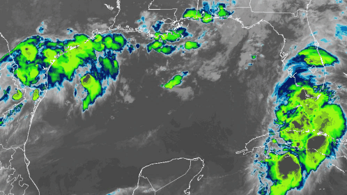
As of 8 a.m. ET Tuesday, Elsa was centered just 55 miles west of Key West, generating sustained winds of 60 mph with higher gusts. The storm’s forward motion was slowing down, moving toward the northwest at 12 mph. Based on the National Hurricane Center’s latest forecast track, Elsa should move near or over portions of Florida’s west coast later Tuesday and continuing into Wednesday. Elsa is forecast to make landfall along the northern Florida Gulf Coast Wednesday morning and then move northeastward across the southeastern United States through Thursday.
The NHC has issued a storm surge warning for Florida’s west coast, from Bonita Beach to the Aucilla River (including Tampa Bay), and a tropical storm warning for Florida’s west coast from Flamingo northward to the Ochlockonee River.
Because Elsa could strengthen back to a hurricane before landfall, the NHC has issued a hurricane watch from Egmont Key to the Steinhatchee River, Florida.
Some areas in the storm surge warning could see water heights of up to 5 feet.
Portions of the Florida Keys, in addition to southwestern and western portions of the Florida Peninsula, could get drenched with 3 to 5 inches of rainfall through Wednesday, with localized totals of up to 8 inches through Wednesday. Across the rest of Florida, 2 to 4 inches of rain are possible, with isolated spots getting up to 6 inches. The heavy rain combined with the storm surge could result in considerable flash flooding and urban flooding, along with minor to moderate river flooding.
Elsa will then move through Georgia and South Carolina Wednesday and Thursday. The storm could produce 3 to 5 inches of rain across portions of southeastern Georgia and the Lowcountry of South Carolina, with isolated totals of up to 8 inches. Considerable flash and urban flooding are possible in these areas, too.
Besides wind damage and potential scattered power outages, Elsa may also produce isolated tornadoes in the Florida Peninsula, southeastern Georgia and the Lowcountry of South Carolina.
The Coast Guard has set port condition Zulu for the ports of Tampa. No vessels may enter or transit within the ports without permission of the captain of the port until further notice. Drawbridges in the area may cease operations as early as eight hours prior to the anticipated arrival of sustained gale force winds, or when an evacuation is in progress.
Click here for more FreightWaves articles by Nick Austin.
You might also like:
Most dangerous highway stretches for US truckers
‘Painful mess’: I-40 bridge closure costing trucking industry $1M daily